

UN Votes To Adopt New World Map Reflecting ‘True’ Africa's Size
Email: online@newsofbahrain.com
Washington DC: The United Nations General Assembly has voted to adopt a new world map that accurately enlarges the African continent while shrinking North America and Europe.
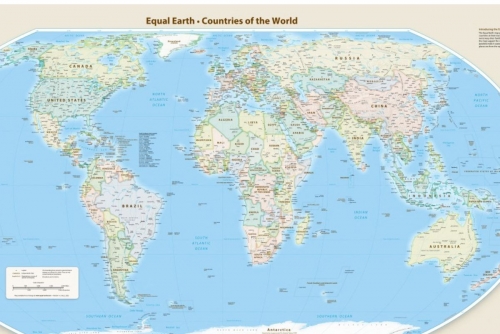
The resolution, aimed at providing a more precise representation of continental landmasses, replaces the traditional Mercator map with the Equal Earth projection.
Supported by 164 countries, the resolution was sponsored by Togo and co-sponsored by France. The United States stood as the sole country voting against the measure, while six states abstained.
The General Assembly urged member nations to abandon the 1569 Mercator projection created for maritime navigation.
Created by cartographers in 2018, the Equal Earth projection corrects severe scale distortions.
The traditional Mercator map historically inflated northern regions like Europe and North America while compressing equatorial areas, causing Greenland to appear almost as large as Africa despite Africa being significantly larger.
Diplomats supporting the change argued that maps shape education and geopolitical perceptions.
Togolese Foreign Minister Robert Dussey noted that distorted maps risk perpetuating inaccurate representations, while French Foreign Minister Jean-Noel Barrot described the adoption as an essential act of truth.
In contrast, US representative Yaryna Ferencevych slammed the resolution, arguing that debating 16th-century cartography undermines UN credibility.
Despite Washington's vocal opposition, the adoption marks a significant global step toward visually restoring accurate relative continental sizes across all international educational and political institutions.
Related Posts