
Cyclone Garance Intensifies, Poses Significant Threat to La Isla de Réunion
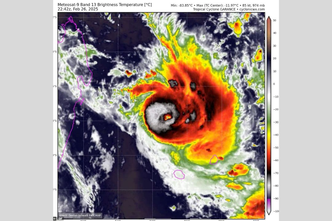
Cyclone Garance is rapidly intensifying this morning, now classified as an Intense Tropical Cyclone, reaching Category 3 status. Satellite infrared imagery reveals a developing and clearing eye feature, as intense vertical heat transfer continues around a well-defined eyewall.
The cyclone's tropospheric moisture content is becoming increasingly robust, and it is currently navigating through a highly favorable thermodynamic environment, characterized by sufficient sea surface temperatures (SSTs).
Garance poses a significant threat to La Isla de Réunion, necessitating swift preparations on the island to mitigate the impending impacts of this dangerous cyclone.
According to the latest Best-Track fix from meteorological sources, Garance has an intensity of 105 knots (120 mph) and a central pressure of 955 mb. However, the improving imagery suggests that the cyclone may be even stronger than these measurements indicate.
The latest projections from MeteoFrance indicate that Garance is expected to approach the western edge of La Isla de Réunion by Friday. Regardless of its exact landfall location, dangerous impacts from the cyclone are a major concern for the entire island population. Residents are urged to finalize their preparations to ensure safety in the face of this escalating threat.
dsgdfgr
Related Posts